So what is lime....
Having a high clay content, the Wrington Vale valley soils were not particularly fertile and as agricultural production became more important to feed the increasing population of the 1800s, so the need to improve soil fertility came to the fore. It was soon learnt that heating limestone to 900°c led to the production of a white powder called calcium oxide (lime) which, when spread on clay soils, helped prepare the soil for the crop to absorb more nutrients, which quickly improved crop yields.
1.8 tonnes limestone (CaCO3) + 0.5 tonne coal burnt at 900 °c
= 1 tonne lime (CaO) + carbon dioxide (CO2)
It was also realised that when exposed to air and moisture this chemical reaction would be reversed and the lime powder would absorb CO2 and form a hard substance – this was soon commercialised with the production and use of lime mortar for building stone houses.
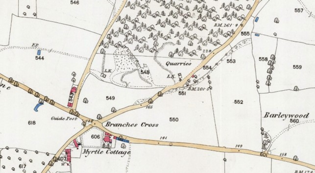
With an abundant supply of limestone on both sides of the agricultural valley, lime kilns to heat the stone were rapidly built by landowners from the early 1800s. County records indicate that 121 lime kills, mostly now ruined, once existed on the edges of Wrington Vale (North Somerset Council Monument List Report 18/05/2023).
The West Kiln – a surprise on our doorstep
The west kiln was built by the Wrington Lord of the Manor, the Duke of Cleveland, who owned the land, in around 1850. It was used to generate lime until the early 1900s when other fertilizers became more readily available eg imported fertilizers from the then owners of Tyntesfield House in Wraxall.
The existence of this kiln was always known and over the decades stone from it was stolen, probably for use in building houses and stone walls in the village.
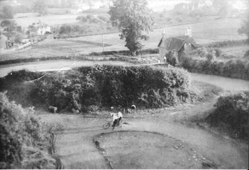
Ivy then took hold, trees sprouted on its top and over the next 100 years it fell into a derelict state. The lower part of the woods became a waste tip in parts – you can still see broken glass from 100-50 years ago (do help and pick some up when you are passing!) The main quarry later became a bicycle velodrome, a popular sport from the early 1900s through to the 1950s.

1885 ordnance survey map
