300 Million Years Ago…
During the Carboniferous era, which spanned from 392 to 299 million years ago, the area now known as Wrington was submerged under the sea. Over millions of years, dead shells and other marine organisms accumulated on the seabed, forming thick layers of debris. The immense pressure from these deposits squeezed out moisture and compressed the material into horizontal strata of limestone rock. This limestone, rich in carbon from the remains of living creatures, is known as carboniferous rock.
Prestow or Prestowe
Over time, the name “Prestowe” has been shortened to “Prestow” on maps. If you explore Prestow Wood (Quarry), you’ll find rocks filled with fossilized coral, specifically Syringopora or organ pipe coral, which thrived in shallow waters similar to modern coral reefs.
Geological Changes
As continental plates moved, they created massive ripples and bulges in the previously horizontal limestone strata. These geological shifts formed the Mendip and Wrington Hills. Over millions of years, erosion wore down these hills, depositing limestone in the valleys. Once the limestone was eroded from the hilltops, the underlying sandstone was also eroded and deposited on the valley floor. The remaining limestone outcrops on the steep faces of Wrington Vale were mined by numerous small community quarries, including Prestow.
What is Lime?
The clay-rich soils of Wrington Vale were not very fertile. As agricultural production became crucial in the 1800s to feed a growing population, the need to improve soil fertility arose. It was discovered that heating limestone to 900°C produced calcium oxide (lime), a white powder that, when spread on clay soils, helped crops absorb more nutrients, thereby improving yields.
1.8 \text{ tonnes limestone (CaCO}_3) + 0.5 \text{tonne coal burnt at 900°C} =
1 \text{ tonne lime (CaO)} + \text{carbon dioxide (CO}_2)
When exposed to air and moisture, this chemical reaction reverses, and the lime powder absorbs CO2, forming a hard substance. This property was commercialized for producing lime mortar for building stone houses.
Lime Kilns
With abundant limestone on both sides of the agricultural valley, lime kilns were rapidly built by landowners in the early 1800s. County records indicate that 121 lime kilns, mostly now ruined, once existed on the edges of Wrington Vale (North Somerset Council Monument List Report, 18/05/2023).
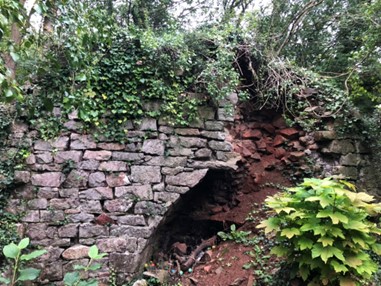
The East Kiln
When the Prestow Wood Conservation Group began working in 2022, the east kiln wasn’t well-known. It was brought to attention by members of the Wrington Local History Society. Research revealed that this kiln was built in 1813 by the Earl of Darlington, who was the Lord of the Manor at the time. Interestingly, the kiln has an unusual gothic style. this means that the east lime kiln predates the west one. This is confirmed by a map from 1817 which shows the east kiln but not the west.
The West Kiln
The West Kiln was constructed around 1850 by the Duke of Cleveland, the Wrington Lord of the Manor. It was used to produce lime until the early 1900s when other fertilizers became more readily available, such as those imported by the owners of Tyntesfield House in Wraxall.
Over the decades, the kiln fell into disrepair, with stone being stolen for building houses and walls in the village. Ivy and trees took over, and the lower part of the woods became a waste tip. The main quarry was later repurposed as a bicycle velodrome, a popular sport in the early 1900s.

Live organ pipe coral

Fossilised organ pipe coral

Photo of Wrington fossil exhibit in Weston-super-Mare museum
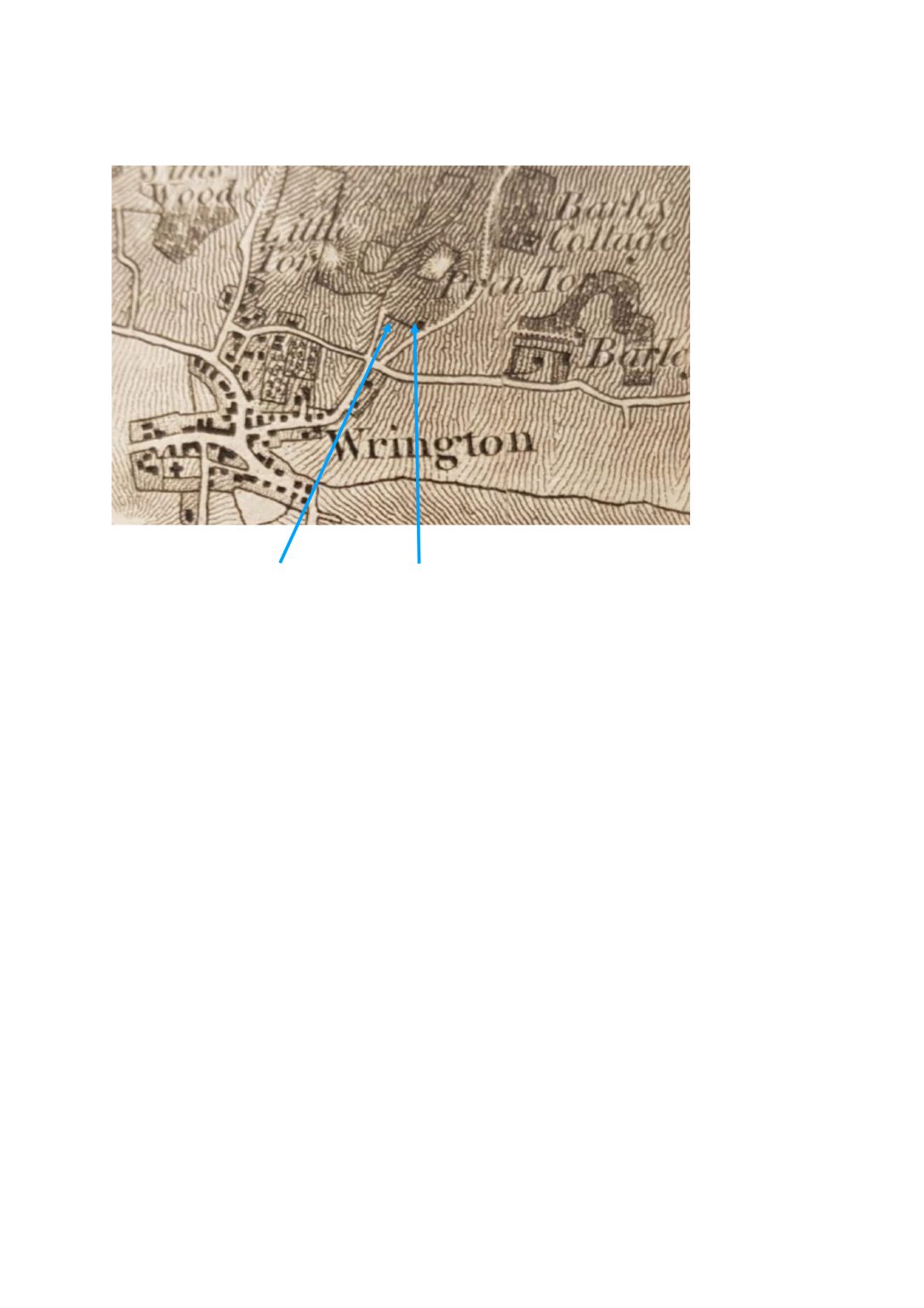
No West Kiln on map East Kiln
This is the map of 1817